When I thought about my first hike in Arizona this past spring, I knew I was prepared for the environment. I had lots of water, sunscreen, and a wide brimmed hat, just like everyone reads about desert hikes. I also knew that it would be comparatively hot as I was coming from Colorado where spring is just a snowier extension of winter, to the Phoenix area where the temperature was in the low 80’s. Hiking in temperatures in the 80’s is not too bad, if you’re used to it but I hadn’t hiked in temperatures that high in months.
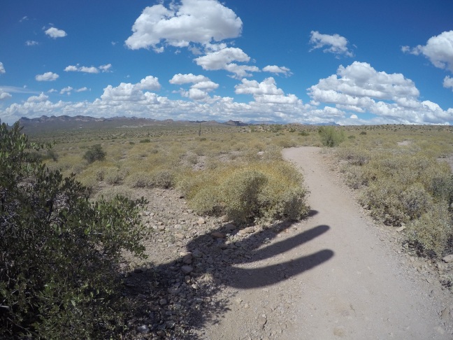
One of the feeder trails, Jacob’s Crosscut
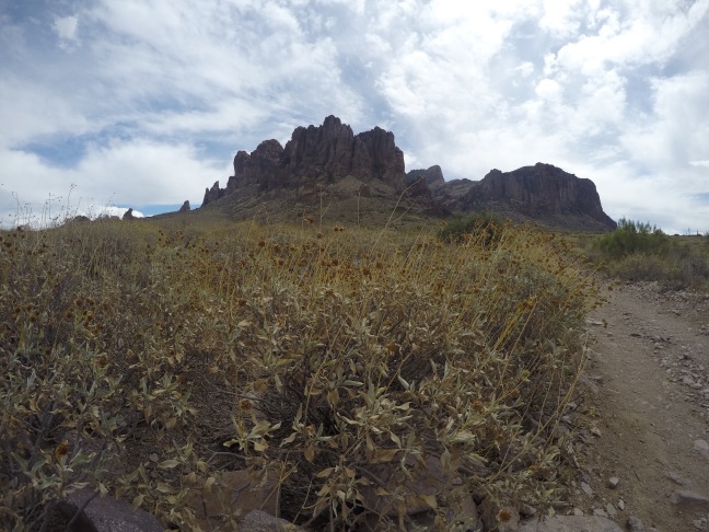
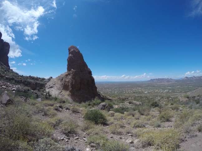
So when I decided to hike in Lost Dutchman State Park near Apache Junction, Arizona, I felt that I was ready for the challenge of a desert hike. What I wasn’t prepared for was how steep the trek would be and, maybe most surprising of all, how high the altitude would be at the top, 4,861′ which is only slightly less than the elevation of my home near Boulder Colorado. I was hiking the Siphon Draw Trail, which didn’t ‘look’ that tough on the map or even when I drove into the park, but I definitely misjudged this one. The first 1/2 or so of the trail is relatively flat with saguaro cacti all around and great views of the Superstition Mountains looming above. After a short while, the trail officially leaves Lost Dutchman State Park proper and enters the Tonto National Forest and the climb really begins from here. About every 30 minutes or so during the hike I could hear a steam whistle from a train that runs through the Goldfield Ghost Town. Normally man-made noises would detract from a hike, but here it added a bit of an old west feel to the area.
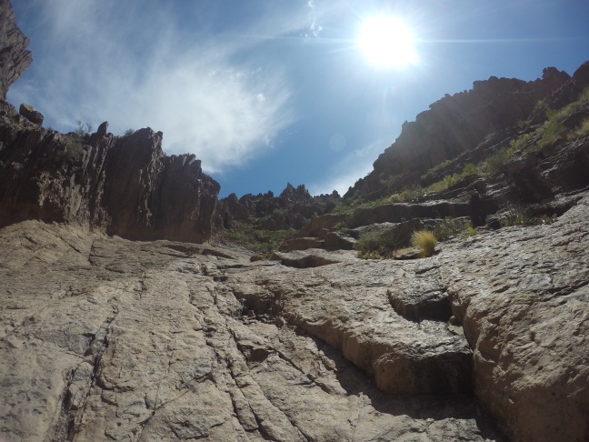
No switchbacks here!
In most places that I’ve hiked steep grades are usually lessened by switchbacks, but there weren’t too many switchbacks on this trail! The Siphon Draw Trail is mainly a vertical trail! I only managed to make it to the area known as ‘The Basin’ and only then realized how tough of a hike this really was. The final mile or so has, according to the park brochure, a 2,000′ elevation gain over the last mile! That would make it the steepest hike I’ve ever done, but today was not the day for me to pull that steep of an ascent off. I may try it again some day and maybe make up that one mile, 2,000′ ascent.
The flat partThe SuperstitionsPhoenix in the distance
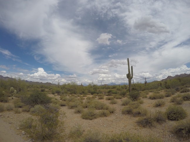
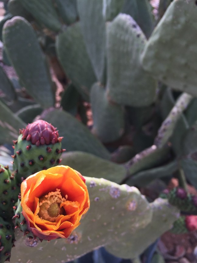
The Peralta Trail is a very popular Arizona hike, and with good reason. Being a relatively short drive from the Phoenix metropolitan area, it provides easy access to great hiking for the majority of Phoenicians (and snowbirds too!). Located on the eastern edge of town off of Highway 60, the drive really starts to get interesting once you leave the pavement of Peralta Road near the town of Gold Canyon. If you’re lucky enough to catch a cactus bloom in the springtime on this section of desert track, you may not even want to get out of the car to hike. There are so many cactus varieties and my botany background is weak but even I could identify flowering saguaro, ocotillo, and prickly pear, all blooming with different colored flowers.
Prickly Pear Cactus Flower, Gold Canyon AZ
The hike begins at the Peralta Trailhead in Tonto National Forest, although this forest is probably different than any other you’ve been to before. This “forest” isn’t full of many trees like you’d see in a traditional forest, but it does have the aforementioned cactus and there are some trees and shrubs along the creek bed. In those trees and shrubs, you may even have the chance to see an Arizona cardinal. When the football team moved to Arizona from St. Louis, I thought for sure a name change was in order because I’d never seen a cardinal west of Kansas, but there are real cardinals in Arizona and their color stands out vividly from the desert landscape.
Most people hike up approximately 2.5 miles to the overlook of Weavers Needle and then head back down. From the trailhead, the first 2.5 miles are almost all uphill with only a few spots along the way to get out of the sun. Take full advantage of these shady areas as the temperature can get pretty hot on the trail. Hiking in the spring and fall can offer temperatures that are decent enough, but summer hiking here would be borderline crazy. Temperatures in the Valley of the Sun can reach into the 110’s and sometimes even hotter. The day of our hike was a near perfect 84 degrees. Even still, we went through three bottles of water each and wish we would have had more. As a side note, when I was at Sky Harbor International Airport, one of the souvenir shops was selling t-shirts that read “Keep Phoenix Hot” along the lines of “Keep Portland Weird” I guess. Clever and I should have bought one!
Several trails can be accessed from the Peralta Trailhead
The trail
Once at the top, you get a spectacular view of Weavers Needle and the Nothern Arizona landscape in the distance. The view is hard earned so savor it, we were really tired and pretty much only stayed for a few minutes. A family sitting near us had packed sandwiches with them and I think my dad was about ready to pull out his wallet to try to buy one. At least one of the kids in the family was also packing heat on his belt and had a Crocodile Dundee worthy knife on it too. Arizona is known for having alternative politics and having kids with guns on a hiking trail is definitely a first for me. We’d seen a few other hikers with guns holstered along the trail throughout the day.
Next up is down, downhill that is. Hiking always seems harder going downhill for some reason. You’re already tired and you’re having to use your legs to slow your body down. This is also a good time to make sure that you focus because there may or may not be a rattlesnake on the trail, just sayin’! A couple was stopped on the trail ahead of us and one of them turned up the trail towards us to let us know that there is a four foot rattlesnake across the trail and to be careful. It was gone by the time we got there but our radar was definitely up from that point on. The couple also warned another hiker on the trail to be careful and when he got to us he had a walking stick and a holstered handgun. He said both were for the snakes. On a serious note, you do need to keep an eye out for snakes. Every place has its hazards. After talking with a few hikers, this snake (allegedly – innocent until proven guilty 🐍) had rattled as a warning to a group of hikers earlier. Here in the desert, the heat is a much bigger concern than the snakes but you need to be aware of both. Wear sunscreen and a hat for the sun and drink plenty of water. Walk softly and carry a big stick for the snakes or something like that says Teddy Roosevelt (not to hit them with of course but for gently nudging them to safety off of the trail, for their own good and for the good of anyone walking the trail, something I actually did a few days after this hike).
The view of Weavers Needle
After finishing the hike, there are many great Mexican restaurants in the Greater Phoenix area to choose from to load up on some of the carbs and sweat you lost out on the trail. We chose the outdoor seating at Los Gringos Locos in Apache Junction. I had a margarita, chips and salsa, a Dos Equis Amber, and a cheese crisp (basically an open faced crispy quesadilla) to cap off a great day hiking with family in the Arizona desert.