Moab

I’ll just get it out the way early, Moab is not for everyone! If your idea of a good time is stalking prey at the nightclub, Moab is not for you! If you like relaxing poolside with an umbrella in your drink and a cabana boy by your side, Moab is not for you, and so on. If you like being active and outside, there may not be a better place in the world for you than in Moab, Utah.

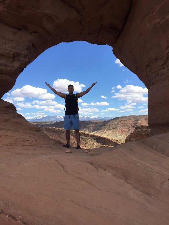
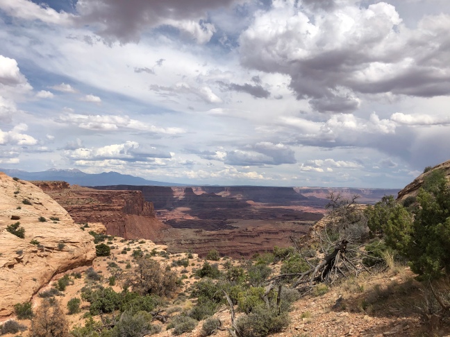
So what does the area have to offer the active traveler? First off, there are two major National Parks just outside of town that are great for hiking and sightseeing, Arches National Park and Canyonlands National Park. Arches NP has Looney Tunes-like terrain which will bring back childhood memories of the Roadrunner versus Wiley Coyote with backdrops like arches, balanced rocks and the reddest side of the color spectrum in the sand and rocks. Canyonlands, for me, is the uncrowded and toned down version of the Grand Canyon. Although the canyon is not as large as the GC, it offers more chances for solitude and is a great place to hike, drive your off road vehicle (on the miles of dirt roads), or even do some long distance cycling on the White Rim Trail.

6B8D1B7A-754F-40FE-A00E-1214675ABEDF
Delicate Arch, Arches National Park (as modeled by Anthony Gonzales)
1CF3B74E-1DD6-4FE3-B574-32522E98A980
Graffiti, Ancient Style (Arches NP)
4EA583A8-8FE1-4F2E-B0E5-7041F08341D4
Canyonlands National Park

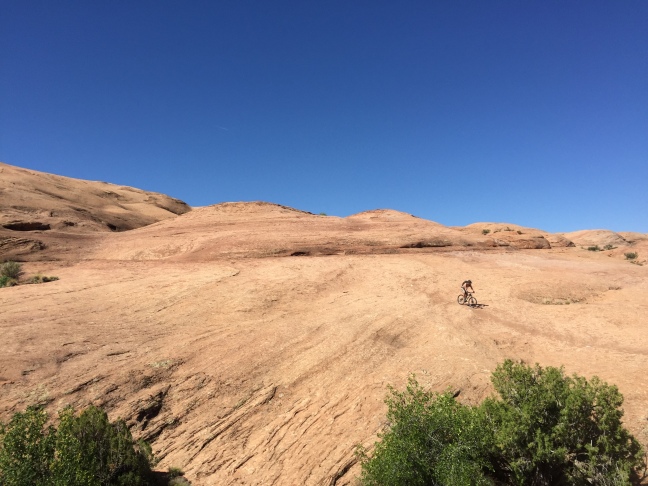
The area is most famous however, as the mountain biking center of the universe. And the trail that elevated the area to that status has to be the Slickrock Trail at Sand Flats Recreation Area, which is a right of passage for anyone coming to mountain bike in this part of the country. Even though Slickrock is the main attraction for mountain bikers, it will likely not even make the top five rides for most people, but is certainly the trail you ride to see what you’re made of. Other popular trails include Amassa Back, Poison Spider, Porcupine Rim and many more.

B93A6821-C139-4783-85F5-938FD69C3748
The Warning (Slickrock Bike Trail)
06607D7A-F25A-466F-94C8-1E3E6BDB7502
Slickrock Bike Trail, Moab, Utah

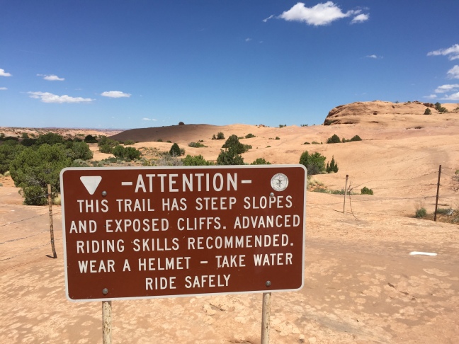
Other popular activities in the area include Jeep and OHV trails. Although this is not something that I do when I go to this area, it looks like those who do have a great time. Even in this fairly parched landscape, the iconic Colorado River practically runs right through town. The river is known for rafting (although not really whitewater rafting in the truest sense), kayaking, and stand-up paddle boarding (SUP). The most popular day on the river is the appropriately named “the daily” which is a few hours of mostly lazy river drifting and a great way to stay cool in the heat.

One of the most commonly asked questions about Moab is “will I see snakes or scorpions?” And the answer is that you might. Moab is a very warm place in the summer and being primarily a desert environment, it’s only natural to think about snakes and other biting, stinging creatures. I have been to Moab maybe seven or eight times and have never seen a snake there. I know they’re there but still haven’t come across a single one yet. I have, however, seen a scorpion there. Scorpions are mostly nocturnal and are best spotted using a UV light to locate them. However, I only saw a scorpion because I intentionally went looking for them, had a UV light, the night was quite warm, and my wife was more patient/persistent in helping to find one. Admittedly, I liked seeing one and wish we had seen more.

FF043352-86CB-4326-995C-630B433B8B13
Scorpion Under the UV Light

Last but not least is the town of Moab itself. Moab as a town is probably not a destination in and of itself but it is a little more than just a gateway town like Estes Park, Colorado or Gatlinburg, Tennessee. Moab is extremely close to the activities that surround it. Five miles from town and you’re at Arches National Park. In Moab proper is where you’ll find the world famous Slickrock Bike Trail with Canyonlands National Park being a little bit farther by roughly 45 minutes. You’ll find the Colorado River just minutes north of town.

There are plenty of hotels and campgrounds to stay at, as well as plenty of dining options. One food recommendation I have would be Quesadilla Mobilla. It‘s a food truck (really, a food truck!), and had to be the single best meal in town and is highly rated on Yelp. The food was reasonably priced, the proportions were large, the toppings and sauces plenty, and the taste was top notch especially after a long day of playing out in the desert.

So if you’re looking for nightlife, go to Salt Lake City (kidding), but if you’re looking for some outdoor adventure and incredibly unique scenery, few places can match what you’ll find in Moab.

0100F780-0004-442F-B8B3-B4F77FA2FF1E
Archview Campground

Sky Pond Trail – Rocky Mountain National Park

With a little bit of effort, you can access one of the most beautiful and scenic parts of Rocky Mountain National Park, an area not accessible by car.  The only way to get there is via an 8.4 mile round trip hike to a high alpine lake known as Sky Pond, which has some of the most dramatic and stunning scenery anywhere in Colorado.

The hike starts from the Glacier Gorge Trailhead, which is in a very busy part of the park, but don’t let this crowded area discourage you.  Trailhead parking is difficult to come by so get there early or take the free park shuttle.  As with most trails, a large number of people will be congregated within the first mile or so from the parking lot, with most people only trekking to Alberta Falls, just under a mile into the hike.

BF198592-4086-43F4-9028-6997F79C7AC0
Alberta Falls
0C58A319-3EEE-4F0B-B81C-322A97412935
The Loch

The trail winds through coniferous forest and follows streams for a good part of the way leading up to Timberline Falls, Lake of Glass and eventually Sky Pond.  Depending on the time of year, you may encounter snow on the trail (like I did, hiking in mid-June).  The snow, combined with steep slopes, was difficult to walk up without falling but was significantly more difficult on the way down, as I fell twice.  Micro spikes would have helped but I probably wouldn’t have worn them anyway, (some did though) since the sections of snow on the trail were short.

2AF1DE26-3744-469A-ACB2-01AEE35D761E
A sample of the trail (June)

I found that this hike had two primary challenges, the first being the altitude.  The pond sits at 10,831 feet so you will definitely notice less oxygen up that high.  The other challenging part of this hike was a rock scramble up (and down) Timberline Falls. The added difficulty to this was, being a waterfall, the rocks were wet and therefore quite slick. A healthy fear of heights and the exposure was definitely a challenge but I made it to the top by being careful and methodical. I just told myself “don’t be a” (insert crass word), and I did fine.  After successfully negotiating the falls, it was only another 15 minutes from there to the end of the trail.

84BE00CC-BB21-4DD1-9E62-F5329B30F986
Timberline Falls
71D543F4-621A-4352-875F-0BEDC5C61E3D
Timberline Falls

Now for the payoff, Sky Pond.  This hike was one of the best hikes I’ve done in Colorado because it basically had it all.  The hike starts in the forest, gets up timberline, follows creeks and lake shores, all while being surrounded by high alpine scenery to rival anywhere.  To me, I would rate this as a moderate hike when considering the distance traveled, the elevation gain, and that darn waterfall rock scramble.  I’ll definitely do this hike again.

35C8E0E5-3BAE-4D1D-8685-5AC841106C63
The Sharkstooth
87755993-BDD5-4191-B85C-7CCD7245DF32
The Sharkstooth
35E5EDCC-D49C-49A3-8D03-BA84DA47BE4B
Sky Pond
5A560087-4B64-4FD7-AF0D-1EBA0F2C46C1
Sky Pond

Hiking During a Pandemic

I always feel better when I’m outside, where the air is fresh and the sunlight provides a healthy dose of vitamin D.  Now that the COVID-19 virus is sweeping the globe, getting outdoors sounds better than it ever has.  Many of us are following the guidelines of “shelter in place” recommendations, working from home and limiting trips to the stores.  In most places however, it is permissible to hit the trail, if not encouraged.  An exception to this is hiking on trails with high foot traffic, that are not in your local area or hiking where you put yourself, and more importantly, first responders at risk.  So stay local, stay safe, but get outside if you can.  It will do wonders for your psyche.

I managed my first hike today since the shit hit the fan and I found it was exactly what I needed.  Hikes always feel good but this one was different, like I needed it.  Admittedly, it was a bit strange at times though, a woman went 15 feet off the trail to go around me, to maintain her distancing, albeit almost triple what is recommended.  This hike was in Boulder after all so I’m used to strange things happening out there.  Extreme social distancing aside, being on the trail and away from the news, it feels like nothing is happening out there in the world.  I remember reading about hikers that were down in the Grand Canyon during 9/11 with no cell service oblivious to the events happening above the rim.  When they eventually made it out of the canyon days later, they learned the terrible news of what happened and they recalled how strange it was that there were no planes flying overhead.  On this day, if it weren’t for hikers wearing N95 masks, you’d never know there was a pandemic going on.

51FF4A01-4893-4FD8-A5B8-45CA3C8C3243

I admit that I do not understand any more than the next person about the virus and where the safest place to be is during all of this.  What I do know is that being outside, away from crowds is a good, and relatively safe place to be.  Just keep your distance, don’t touch anything, bring hand sanitizer,  gloves, and a mask and you can have a brief respite from the stresses of our new reality.

It’s important to keep our bodies and minds active and healthy during this time.  Get some air if you can and be safe out there!  So if you get a hike in, be safe, stay local, don’t take unnecessary risks, and obey the law!  In case you need a little inspiration, here are a few reminders of what’s out there…


Hiking in Indiana? That’s right, Indiana!

I’m convinced that you can hike anywhere, even in the cities. The Irish call it “walking” and some walks are more like hikes and hikes more like walks.  Confusing?  Just put on your pack and get out there!  Ever walked in San Francisco? It’s harder than most hikes you can find in almost any National Park.  Whenever I travel to a new place, I usually get out a map and start looking for blank spaces or green spots near to where I’m traveling to.  On a recent trip to Indianapolis, I spent some time looking at a map and found some empty spaces and greenery south of the city in Brown County, near the small town of Nashville, Indiana that is.  Brown County State Park (Indiana’s largest), Hoosier National Forest, and Yellowwood State Forest all show up well on the map and roughly just and hour or so from Indy.

0C322487-41D2-47F3-AA89-C957A27EB2D8
The hills of Brown County State Park | Indiana

So let’s just start where I did, in Brown County State Park.  The park has about 20 miles of hiking trails and another 27 that are multi-use, which compared to some other places is not much. But I didn’t come to Indiana to hike, it was on the back-end of a business trip that I extended a couple of days to see family in the area (Bloomington) and I managed a little exploring on the side as well.  My hotel was in the quaint town of Nashville about a mile from the north entrance of the park and it turned out to be the perfect place to stretch my legs and get some fresh air.  My first hike was on the 2.2 mile Fire Tower Trail (aka Trail 10) which follows ridges and ravines as a loop.  The loop begins and ends at a 90’ converted fire lookout tower that now serves as an antenna tower open to visitors to climb.  Admittedly, I have a healthy fear of heights and my first climb at the beginning of the hike ended in me seizing up about halfway to the top and turning around.  After hiking the loop, I decided to try again and this time made it up to the top.  I am actually a bit surprised that you are legally allowed to climb this tower but I’m grateful that it was. Nearby is a small nature center that I enjoyed so much that I realized that I’m getting old.  Inside, there are living and non-living (taxidermy) fauna to view.  Live animals included snakes like the Timber Rattlesnake, Copperhead, Black Rat, and Milk (red on black, friend of Jack). There is also a two-way mirror looking out into a bird feeder and this was clearly (intended pun) were all of the action was.  Very fat squirrels battled it out for the primo spots and birds (including my favorite, the cardinal) tried to stay a safe distance away from them, while still managing a free meal.

98200430-E664-4214-A49E-F19031ED1CCB
Male Cardinal

Another nice trail in Brown County State Park was the short but scenic Ogle Lake Trail.  At only 1.5 miles, the trail is really just a warmup to some of the other connected trails you can hike from this area.  I connected to the Taylor Ridge Trail, which can add another 5.5 miles onto your hike (I didn’t make it that far).

F20C42DB-16B6-40E1-AA5C-1C9CCF521609
Ogle Lake

All in all, there are plenty of shorter hiking options in southern Indiana that you might enjoy the next time you’re passing through.  If you’re looking for some decent comfort food, try the Nashville General Store and Bakery in Nashville.  For really good apres randonnee beers, try Upland Brewing Company in Columbus (I had more than one Modern Tart Kettle Sour Ale).  So if you happen to be in Central Indiana and you need a nature fix for a day or two, Brown County is a good place to be.

Step Away From The Car… In Yellowstone

If you don’t get more than 100 feet from your car when you go to Yellowstone National Park (YNP) in Wyoming that would be a shame, but I will not judge you… however I would encourage you to hike your way to the front of the line.  In doing so, you’ll leave the vast majority of the parks visitors far behind.  YNP has some of the most incredible roadside attractions nature can offer: steaming geysers, large herds of bison, elk and deer, as well as apex predators like wolves and bears.  But all of this nature in one place has one big disadvantage: Disneyland-like crowds with no skip the line pass to make viewing it all easier.

027824A1-D89E-47AA-BDA8-331F2EFB6101
Bison or Buffalo?

My wife and I recently spent a few days in Yellowstone and roughly split our time equally between seeing large swaths of the park from, or very near to, our car with the other half of our trip walking into the woods to experience a much different Yellowstone than most people do.  From the car, there are the massive Yellowstone Falls in the Grand Canyon of the Yellowstone as well as huge herds of bison that seem very comfortable weaving through the cars and people who dare to get too close.  Bears are often seen here from your car and even wolves show face for those who are either lucky, or patient, or both. There are also thermal features within close proximity to parking lots such as the famous Old Faithful Geyser and the incredible colors of the Grand Prismatic Spring.

C1E5A934-4AE6-404B-81A1-B80310A51543
Lower Yellowstone Falls

If you get out of your car and venture into the woods, you may be rewarded with a much more intimate experience in one of America’s most popular national parks. Our first hike in the park was 4.8 miles round trip to Lone Star Geyser, which can erupt up to 45 feet into the sky. This geyser erupts every three hours so timing is everything, and we lucked out and arrived (with no planning mind you) only 10 minutes before the geyser went off.  The hike is uphill to the geyser but is not steep and follows an old road that has been closed to automobile traffic (bikes are allowed). A few minutes of waiting after reaching the end of the road, the geyser began to pick up steam (pun intended) and showed rumbling signs that an eruption would be coming soon.  The geyser erupted for about 18 minutes with water shooting up first, then a few minutes of steam and it was a wonderful reward for the relatively short 2.4 mile hike to get there.  We felt like our efforts to have hiked there were instantly rewarded as there were only about 10 other people there to witness this very cool display whereas Old Faithful can have as many as 2,000 people watching an eruption.  It was also refreshing to have an unobstructed view of the geyser with no signs or ropes in the way and the best part was that it truly felt like this is how we were meant to see it, au natural so to speak.  We worked for this experience and we were richly rewarded for our efforts.

B19F86D4-0F7B-4A51-AAA9-7AB5BFD2794C
Lone Star Geyser

Our second hike was to see Fairy Falls which is accessed near the very busy Grand Prismatic Spring area.  Once you get past the large crowds of this popular spot, you’ll find a much smaller group of sightseers on the way to the falls.  Fairy Falls is a very tall (197 feet) cascade, one of the tallest in the park, but for us the true gem of this hike unexpectedly turned out to be Imperial Geyser.  This geyser bubbled and burped the entire time we were there and again there was hardly a soul there, this time only four other hikers.  If you make this an out and back, the distance is around six miles, but there are also options to add more distance by linking to other trails in the area, which we did to add another three miles or so.  While on one of these connector trails, we came across a lone male bison just off trail that really capped off what was a very unique hike. Seeing a big bison from your car can be intimidating so imagine seeing one out on the trail!  We stayed back a safe distance to take some photos and didn’t want to end up on the news like so many others recently who have gotten too close to a wild bison.

Not everyone can hike but if you can, do.  I’m not trying to diminish the experience for others who do like to see the park from the relative safety of their cars and only walk the boardwalks. We did our fair share of this type of sightseeing, just like everyone else and it was great.  However, wildlife encounters seem to have a more authentic feeling when you see them from the trail instead of the road. The power of a wild buffalo is more pronounced when you don’t have your car to save you.  Walking through forests that have grizzly bears heightens your awareness to your surroundings (carry bear spray) and that also adds a different dynamic to the experience.  Geysers and other natural features experienced miles from the nearest parking lot mean that you might have it all to yourself, without man-made barriers.

A00B035A-E8E7-4BAE-A575-A10CD717971C

A0C8A759-5F10-4D84-892F-A6A45200710F
Twilight on Yellowstone Lake

So, if you can get a hike or two in during your stay, do it and you’ll be glad you did. Enjoy a more secluded Yellowstone experience because most people will be at the lodge, in their car, or never far from it, and that means you can experience something rare in Yellowstone, solitude.

5CB6ADF1-FF21-4045-B4C7-0145F942A676
Bison in Lamar Valley


Custer State Park, South Dakota

Most people who travel to the Black Hills of South Dakota are intending to visit Mount Rushmore and perhaps even the Crazy Horse Monument, while on their way somewhere else (Yellowstone National Park for example).  However, visiting Custer State Park (CSP) with its open prairies, dense forests, and large buffalo herd, can be the perfect complement to the more acclaimed (and crowded) tourist draws in the Black Hills.

Custer State Park is located in the Black Hills of southeastern South Dakota, several hours drive from any big city (like Chicago, Denver, or Kansas City).  While Mount Rushmore and Crazy Horse are must sees on any outing in the Black Hills, they are each easily visited in just a couple of hours. If you’re staying in the area for more than one day and want something a little bit off of the main tourist trail, then Custer State Park can be the perfect chance to explore deeper and to get to know the area. For starters, the park is immense, with over 71,000 acres of rolling prairie and forested hills with lots of space to spread out, it is nearly six times larger than Mount Rushmore National Park.  CSP is probably best known for its large herd of roughly 1,500 free roaming buffalo but there are also many other animals that can be seen in the park like antelope, deer, goats, and even a herd of burros.  There are also miles of hiking trails, lodges, campgrounds, and lakes to explore.

The trailhead to South Dakota’s tallest peak, Harney Peak (or Black Elk Peak as it is now known), is located just within the park and the summit can be reached via a moderately difficult seven mile hike. The peak tops out at an elevation of 6,200 feet at the summit, making it the tallest mountain in South Dakota and the tallest in the United States east of the Rockies.  At the top, there is stone fire lookout tower, making it a unique summit to rest and take in the great views of the plains below.  If you know where to look, you can even see the backside of Mount Rushmore from up there.  Elsewhere in the park, there are also many miles of less strenuous hikes if this seven mile hike isn’t for you.

bc1a7b0b-c6a5-4d97-bd2b-f57564782288
Fire Lookout Tower, Harney Peak
f534d1f0-945a-4e48-86a0-369ab3fb75ba
The backside of Mt. Rushmore in the distance, sightseeing helicopters above
bf02fc85-e537-4711-b6e3-4e2f9f550539
One of many hiking trails within the park
712ea5a1-a4c2-442d-a3ca-c5e79f6bc956
Cathedral Spires

The thrill of seeing wild, free roaming buffalo is the closest thing to what it must have been like in the old west that we can experience, and there are so many of them that they often kick up huge dust clouds as they graze. If you’re lucky enough to be around the large herd, you can have the animals that seem as big as your car, completely surround you.  Buffalo are a truly magnificent animal and you can really appreciate that when they’re in close proximity and you can experience that here, without the crowds.  The buffalo photo above was taken on a dirt road with not another person within miles of us and we could literally touch it out of our car windows it was so close (we didn’t touch it by the way).

So if you’re planning a trip to the Black Hills or if you’re just passing through on your way somewhere else, think about staying an extra day and exploring Custer State Park, it’ll probably be the best part of your trip.


Rocky Mountain National Park and Estes Park – The Four Seasons

Rocky Mountain National Park (RMNP) is the closest national park to my home in Colorado and I consider it my base park.  It takes me about an hour to get there and I’ve been there enough to know how different the seasons are in both RMNP as well as in its gateway city, Estes Park.  The seasons here are wildly different – from the extreme temperature swings to the number of visitors.  Here is my take on what each of the four seasons is like:

Summer

DB3A8735-6F53-46D6-86B0-5BD2D4C9447D
Death and Renewal

Estes Park – In the summer, Estes Park is completely overrun with tourists.  Despite this, it shouldn’t stop you from visiting.  The weather is nearly perfect and is typically at least a few degrees cooler than the cities below on the plains, like Denver or Boulder. If you’re really looking for a cool down, you can cool off even more if you head high up into Rocky Mountian National Park.  The town itself is a typical tourist town but with a mountain/western twist.  There are the obligatory t-shirt, salt water taffy, chocolate, and ice cream shops that you would see in almost any national park gateway town. What makes Estes unique is the surrounding scenery, which wouldn’t be out of place in the Swiss Alps, with its huge snow-capped mountains and valleys.  What is lacking though, in a good way, are flashy resorts as in other Colorado mountain towns like Vail or Aspen.  Here, there are mostly small motels and cabins along with the place that Stephen King made famous, the Stanley Hotel.

E4FEB49B-C96A-47FB-B24C-9C3EDEC449AD
15 feet of snow and it’s summertime

RMNP – The throngs of tourists are here too, unfortunately.  However, all you need to do is to start a hike on almost any trail and you can lose 90% of them after only a mile or so from the trailhead.  Hiking in summertime at these elevations means being prepared by starting early to avoid afternoon thunderstorms. If you don’t consider yourself a hiker, consider a drive up Trail Ridge Road, a journey which can yield a somewhat unique activity, a summertime snowball fight or building a snowman. The highest point in the pass is 12,183 feet (over two miles high) and that leaves enough snow year round for winter games, even in mid summer. The wildlife also move up to higher elevations in summertime, seeking greener pastures.  Up at these higher altitudes, you might see large herds of elk and bighorn sheep in the alpine tundra, way above the height where trees grow.

Autumn

8FAE2E29-0537-465E-92E8-A644C769BA97
The bugling elk

Estes Park – Surprisingly, Estes park can still be quite busy during the fall.  Some might think it has to do with fall colors but the area around Estes Park and Rocky Mountain National Park really doesn’t have an abundance of aspen trees. For most people, the primary reason they come up here in the fall is to hear and see elk during the ‘rut’ which is the mating season.  And why would you want to hear bugling elk during the mating season?  The reason is that their mating calls sound like a sort of ancient call that can be heard from far off. It is a difficult sound to explain and do it justice, but is a truly a breathtaking and mesmerizing experience to see and hear, and something that simply must be heard in person. This is the main reason people flock to Estes Park in the fall, the elk literally bugle as they’re walking on the golf course, through parking lots right in town, as well as on the grounds of the Stanley Hotel.

RMNP – As with in Estes Park, the reason to head into the national park at this time of year is to see and hear the elk.  Although being bumper to bumper with like minded people might not seem like something you want to do, you can still go into the park and hike into the woods where you might find yourself all alone on the trail in the middle of a large herd of bugling Rocky Mountain Elk.  Last October, my wife and I went on a hike, away from the main areas of the park, and started to hear bugling in the distance and were soon surrounded by around 100 elk on both sides of the trail without another human anywhere near us.  The park brochure cautions you against approaching wildlife, so by all means keep your distance. But if you happen upon a large herd while hiking the trails, excercise extreme caution and keep a safe distance.  I usually like to have a big tree nearby just in case.  The bulls are extremely aggressive during this time of year and they are big, averaging around 700 lbs, and strong enough to inflict great bodily harm if they decide you’re too close.


Winter

6399DBA7-4519-4B4B-99FD-C8D1CDF8C455

Estes Park – If you’re  looking to experience a tourist town without the tourists, this is the time of year to come to Estes Park!  You will not have to fight for a table at your favorite restaurant, there will be no bumper to bumper traffic, there’s plenty of parking, and you can have the place virtually all to yourself.  Unlike other Colorado mountain towns that usually see a massive influx of people in the winter, Estes doesn’t have a ski resort (although it once did) to anchor its winter economy.  Because of this, Estes sees a very dramatic drop in visitation in the winter.  As an added bonus, a stay at the Stanley Hotel in winter can give just a sliver of what inspired Stephen King to write ‘The Shining’.

RMNP – The park is at its best, in terms of scenic beauty in the dead of winter.  The mountains are usually covered with snow, sometimes approaching 10 feet.  Winter activities include snowshoeing, cross country skiing, and wildlife viewing (although seeing animals inside the park during winter is less likely). Some areas, such as around Bear Lake, are still crowded but it can be much easier to find areas of the park where you’ll need your snowshoes to walk through the snow. It is simply one of the most beautiful winter scenes in all of Colorado.

Spring

5C9C24BC-C2C0-427C-BEEA-2CA5E49A440B
Always snow up in the highlands

Estes Park – This town still doesn’t really get going again until late spring. In most places, spring begins a steady warmup towards summertime but at this altitude and being in Colorado, Estes Park typically experiences its snowiest months of the year in the spring.  Traditionally, February, March, and April are Colorado’s months for heavy snow and blizzards.  Eventually however, the snows slowly give way to longer and warmer days and the area begins to thaw and creak to life.

RMNP – Spring in the park is the beginning of the big melt.  The east and west sides of the park are connected by Trail Ridge Road, but due to heavy winter snow, the road is impassable until the weather warms and crews can begin plowing the road. When the road finally opens, it becomes symbolic of winter’s deep freeze losing it’s grip on the park. The animals get to moving again and the large numbers of people begin to make their way back to the park that had been tranquil for several months.

In any season, the area is unique and beautiful. During the cold winter months, it is quiet and peaceful.  In the warmer months, it is energetic and bustling but no matter what season, it is worth a visit and will not disappoint.

58FD70D3-185D-4DF7-9082-2C048AA24385
The less visited area of the park known as ‘Lumpy Ridge’

Nuclear Hiking : A walk through Rocky Flats

LThe land that was once considered one the most polluted places on earth has now been cleaned up (we hope) and is now open to limited recreation, known now as Rocky Flats National Wildlife Refuge.  And guess what?  You can hike there…for free!

Admittedly, this hike does have a bit of an odd feel to it knowing that nuclear triggers were made here.  However,  it did not have the ‘eerie’ feel that the area around Los Alamos has (the place recognized as the birthplace of the atomic bomb) which has a strong government town atmosphere and feels as though it holds many secrets.  Rocky Flats is more out in the open, kind of in your face, whereas Los Alamos is hidden behind trees and rocks. At the Flats, the Department of Energy still has a presence at the refuge monitoring the site. I noticed there are still large mountains of dirt being moved around by heavy machinery creating dust that gets carried in whatever direction the wind blows.  Let’s hope that this dust is nothing more than common everyday dust.

D8CB8B24-6ADB-4CCB-B8E0-9C24B845EAC8
Earth moving operations

If nothing else, the refuge provides the area with some new trails to try out and is considerably different than any other hike that you can do near Boulder. There is a reason why the area is called Rocky Flats as it is the flattest hike I have done in Colorado.

7D936D4E-0A1F-4EAF-95DE-A1BB5682CCC1
The ‘Flat’ in Rocky Flats

The view of the Flatirons in Boulder is very good from here but I found myself looking at them wishing I had chosen to be in the scenery instead of viewing it from a distance.

A few notes about the hike:

  1. The park service allows hikers, bicyclists, and equestrians on its 11 miles of trails.
  2. The path is mostly gravel and dirt suitable for mountain bikes but probably not road bikes.
  3. The main entrance is just off of Colorado state highway 128 and has free parking for about 10-12 vehicles. There are really no services at the trailhead but there is a portable toilet.  There was also no fee to enter the refuge, that I could see.
  4. The trail is very exposed, with only a few trees, and virtually no shade.
  5. I saw little to no wildlife during my hike, a common sparrow being the only fauna I noticed. However, I was hiking in late morning, not the best time to view animals. The park brochure mentions deer, elk, prairie dogs, coyotes, jackrabbits and porcupines as animals that you might see.
8EEACD5F-3EE8-449A-B801-EC7135227149
At the trailhead, for your reading pleasure

In summary, this is a place of contrasts where you have abandoned ranches next to modern wind generators, protecting wildlife in a place that once made nuclear weapons, and maybe the least important was the hike itself which was a flat prairie hike in full view of the beautiful foothills around Boulder. The hike is one that I would most likely not do again but in fairness, I haven’t seen the whole 11 miles of trails within the refuge.  If you like flat, treeless hikes with great views of the mountains, this is the place for you.  It just wasn’t for me.

I give this hike a ‘glowing’ review! 😬

3052BFB1-DE04-4572-874C-B8018A95719E
Just outside the refuge boundary, an artist with a very strong opinion

Bigfoot Threw A Rock At Me

E979E34B-2ECD-4AEA-B7A0-2272166A221A
The eerie but beautiful Oregon Coast Trail

For the record, I don’t believe in folklore legends like the Yeti, the Loch Ness Monster, or the Headless Horseman, but when I decided to hike a section of the Oregon Coast Trail this summer, I did not expect anything other than some sea mist and tall trees. What I actually came across that day was something that may have challenged those beliefs.

I have watched all of the same documentaries that you have about the legend of the Pacific Northwest, Sasquatch (a.k.a. Bigfoot). As a child, these documentaries terrified me and gave me no desire to ever go into the woods of Washington and Oregon. Seeing the grainy video of Bigfoot walking through a clearing in the trees was enough to give me nightmares.

The section of the Oregon Coast Trail I decided to hike (alone I might add) was in Oswald West State Park, near the town of Manzanita, about a two hour drive from Portland. I was planning an out and back and decided I would turn around when I got tired. So I did an about face and headed back towards the trailhead after two uneventful miles, due to a cold wind and tired legs. As I was descending the overgrown and narrow trail, I heard noises ahead of me that I have never heard before in the forest. Granted, I was in a different part of the country and there are always unique and unfamiliar sounds in the wilds of a different region, but what I heard was what sounded like a baseball bat striking wood, but this didn’t overly concern me. My initial reaction was that there was a black bear ahead of me turning over logs looking for food and/or crashing through the brush, but the sounds didn’t quite match what I could rationalize as being a bear. As I approached the section of the trail where the sounds were at their most intense, I stopped to see if I could see anything moving in the thick underbrush, at this point still expecting a black bear. I saw only thick green vegetation.  After only a few seconds, I heard what sounded like three or four objects being dropped from the trees in different spots. This too did not make sense to me since I could imagine maybe a single pine cone falling from the trees but not three or four in rapid succession. I was very confused about what might be making these sounds. Maybe squirrels were dropping little pine cone bombs onto a bear below them to scare it off? This seemed plausible but not likely.

What happened next was one of a few times in my life that I have literally felt the hair on the back of my neck stand up. As I continued looking into the dense forest, an object that looked like a rock came flying out of the thicket and landed about 20 yards away from me. This had an effect on me which I have never had on a hike in my lifetime, it was such a disturbing feeling I couldn’t get to the trailhead and my car quick enough. I hauled ass out of there and made it to my car without further incident and didn’t hear or see anything else, but was still rattled by what transpired.

73C9B63E-23F4-439F-BDE3-CAFDF2FD491F

So what was it? Maybe it was a bear (but bears don’t throw rocks.) Squirrels can drop things on unsuspecting life on the ground below them but the object that came towards me didn’t fall from a tree. In Colorado, where I live, a mountain biker was killed last year while he biked on a trail near Colorado Springs and the person responsible has not been caught. At the time of this writing, a college student is missing on the same mountain and I hope his disappearance is not related and that he returns safely. It makes me think though that there may be someone that doesn’t want people in the area. So maybe there was someone up there who is trying to scare off hikers because they are getting too close their property, or they don’t like the hikers passing through. Maybe it was someone just having a little fun at my expense? I had just passed two hikers, the only two I saw on the entire hike.

Or maybe it was Bigfoot?

7DD66BD7-A2BB-42B9-A45F-A7F729C51D65

The Quest for Lava: Kilauea Volcano

I sat in a helicopter with no doors, buckled tightly and quite nervous, looking at flowing and glowing lava for the first time in my life. We were still over 3,000 above the lava flows that were both beautiful and very destructive.  There were fountains and rivers of molten rock making a path to ocean and taking out homes, and anything else in its path, along the way.

This would be my second time in Hawaii, with the first visit having missed the goal entirely of seeing red hot liquid magma, while the second trip took a helicopter ride on my last day to finally see it. There were many attempts prior to the helicopter ride, all ending up in failure, but failure in this case was definitely a wild ride.

Ever since I was a kid, I have always wanted to visit the Big Island of Hawaii. I can remember photos of exotic looking black sand beaches, tropical fish, and active volcanoes. But for me, seeing lava flowing from an active volcano was definitely the number one draw. I wanted to see lava, actual lava, spewing from the Kilauea Volcano, just like I had seen in pictures and videos. Kilauea volcano has been erupting essentially nonstop since 1983 (since I was in junior high school) and getting to see a live lava flow with your own eyes is pretty much a slam dunk, at least that’s what I thought. So with family, I was fortunate to get to visit the island of my dreams for the first time and try to check off a couple of other bucket list items while we were there.


IMG_0260
At least there aren’t any ‘real’ hazards to worry about!

We arrived in Hawaii and made plans to see the sights, including Kilauea, which is mostly located within Hawaii Volcanoes National Park.   Inside the park, there is evidence of volcanic activity everywhere with steam rising from the ground in many places along the rim and a large amount coming out the Halemaumau Crater, the main and largest crater in the park. However, there were no rivers of lava anywhere that we could see from inside of the park so we waited until it got dark to look at the crater at night and could see the orange reflection of lava in the clouds of steam. This was still pretty cool but not the rivers and fountains of lava I dreamed about as a kid, and it certainly wasn’t seeing lava directly with my own eyes. Reflections don’t count!

We decided to come back to the park later in the trip and hike into the crater of Kilauea Iki (Little Kilauea).  The hike is a four mile loop hike that starts in a rainforest at the rim of the crater, descending onto the barren crater floor.  The hike starts at the Volcano House in Hawaii Volcanoes National Park, with a restaurant and gift shop on the rim.  As you step out of the Volcano House and into the rainforest, you’ll be in perhaps the closest example of a ‘perfect’ rainforest you can imagine, almost like what you think of when you imagine what the Amazon rainforest would look like. The greens are greener, the foliage is denser, and all of this is as you descend into a volcanic crater where the terrain couldn’t be more different.

IMG_1318IMG_1316

The crater floor is paved with thick black hardened lava that resembles a highway that has suffered massive earthquake trauma, minus the painted lanes and auto traffic. As you walk along the valley floor, steam shoots out of small cracks in the rocks and is a subtle reminder that you are very close to the core of an active volcano.  Kilauea Iki however, is not the place for active flows, it’s just a great place to hike in a crater that once had a massive fountain of lava pouring from it way back in 1959.  As an added bonus, there is an excellent lava tube, the Thurston Lava tube, just a short distance from the main trail.  It’s well worth the extra half a mile or so that gets added onto the total hike and it is one of the most visited sites inside of Volcanoes National Park and all of the Big Island. This hike had evidence or lava everywhere, it just didn’t have the hot flowing kind. So we left Hawaii this time without seeing lava but otherwise the Big Island was, and is, an amazing place to spend a couple of weeks. We would return two years later to a very different volcano.

IMG_1311
The crater floor

This time the volcano was going nuts. You’ve all heard how devastating the Kilauea Volcano has been from news outlets this year with so many people losing their homes to the lava flow. I have so desperately wanted to see this rare phenomenon but not in this way, while people are losing their homes.  So I was conflicted but ultimately felt like I was not disrespecting anyone by simply wanting to witness it myself.

We set out from Kona one day for the long drive out to the Puna district in search of lava with hopes of seeing it in an area where homes weren’t being immediately threatened. We made our way to Pahoa where the first signs of the volcano could be seen. The first hint that anything at all was happening was the discolored smoke that was rising from the area just south of town and it was in the town where there was a command center set up for coordinating rescue efforts. This was truly the first time I felt like trying to see the lava was something more than just a cool thing to see, it was truly an active situation affecting the lives of people in a real community.

The roads leading in and out of the active lava flow area were either closed or only open to local traffic and were guarded by local police along with the Hawaii National Guard.  We drove to a couple of these roads and were turned around by the blockaded intersections. I was beginning to get discouraged but found one back road on a map that looked promising and might yet yield an opportunity to see the lava flow from close up. It was a very small road that followed the shore line and it showed that it would eventually lead an area that would get us very close to the flow. As we rounded the last turn in the road before getting to this spot, there was another blockade with the National Guard controlling access to the area.  This was a devastating blow to my hopes but the soldier pointed us down the highway back towards Pahoa, and according to my maps, would lead us right past the open fissures.  As we drove along this road, there was a slight ridge between us and the lava flows and it was just enough to prevent a sighting.  That was it! No lava for me! Only I could manage to not get to see lava when a volcano is in full eruption mode. Perhaps it was all for a reason that I didn’t get to see lava that day.


IMG_7386
From 3,000 feet above the lava flow and a very creepy dark shape just to the right of the lava!

So after a lifelong desire to finally witness this incredible natural event, it was, admittedly not exactly under the circumstances I had hoped for.  I feel fortunate to have seen the incredible power and beauty of Kilauea and I hope the families that have been displaced can rebuild their homes and their lives.  I did achieve a bucket list goal and it was incredible. Now I have added a more specific bucket list goal: to see lava while standing on the ground, close enough to feel the heat. Maybe to a place where the flows are not threatening homes or lives? Maybe a trip to Vanuatu?