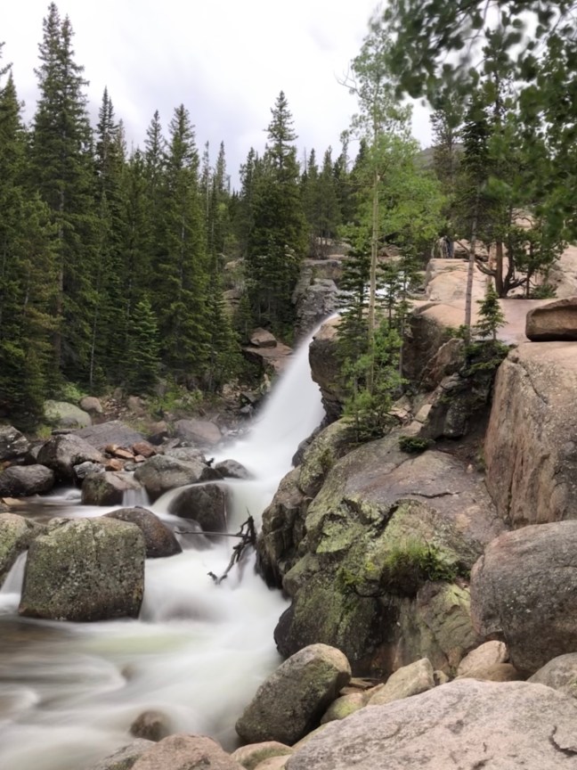
With a little bit of effort, you can access one of the most beautiful and scenic parts of Rocky Mountain National Park, an area not accessible by car. The only way to get there is via an 8.4 mile round trip hike to a high alpine lake known as Sky Pond, which has some of the most dramatic and stunning scenery anywhere in Colorado.
The hike starts from the Glacier Gorge Trailhead, which is in a very busy part of the park, but don’t let this crowded area discourage you. Trailhead parking is difficult to come by so get there early or take the free park shuttle. As with most trails, a large number of people will be congregated within the first mile or so from the parking lot, with most people only trekking to Alberta Falls, just under a mile into the hike.
Alberta FallsThe Loch
The trail winds through coniferous forest and follows streams for a good part of the way leading up to Timberline Falls, Lake of Glass and eventually Sky Pond. Depending on the time of year, you may encounter snow on the trail (like I did, hiking in mid-June). The snow, combined with steep slopes, was difficult to walk up without falling but was significantly more difficult on the way down, as I fell twice. Micro spikes would have helped but I probably wouldn’t have worn them anyway, (some did though) since the sections of snow on the trail were short.
A sample of the trail (June)
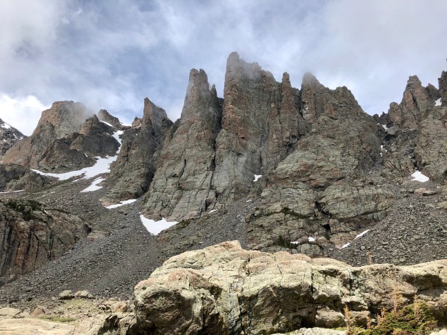
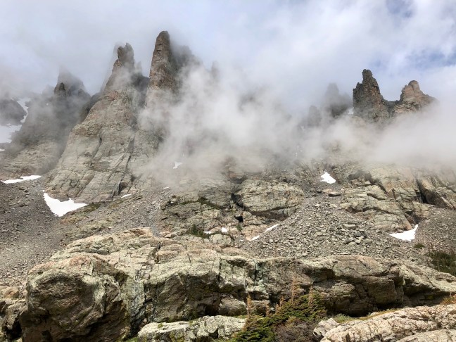
I found that this hike had two primary challenges, the first being the altitude. The pond sits at 10,831 feet so you will definitely notice less oxygen up that high. The other challenging part of this hike was a rock scramble up (and down) Timberline Falls. The added difficulty to this was, being a waterfall, the rocks were wet and therefore quite slick. A healthy fear of heights and the exposure was definitely a challenge but I made it to the top by being careful and methodical. I just told myself “don’t be a” (insert crass word), and I did fine. After successfully negotiating the falls, it was only another 15 minutes from there to the end of the trail.
Timberline FallsTimberline Falls
Now for the payoff, Sky Pond. This hike was one of the best hikes I’ve done in Colorado because it basically had it all. The hike starts in the forest, gets up timberline, follows creeks and lake shores, all while being surrounded by high alpine scenery to rival anywhere. To me, I would rate this as a moderate hike when considering the distance traveled, the elevation gain, and that darn waterfall rock scramble. I’ll definitely do this hike again.
I always feel better when I’m outside, where the air is fresh and the sunlight provides a healthy dose of vitamin D. Now that the COVID-19 virus is sweeping the globe, getting outdoors sounds better than it ever has. Many of us are following the guidelines of “shelter in place” recommendations, working from home and limiting trips to the stores. In most places however, it is permissible to hit the trail, if not encouraged. An exception to this is hiking on trails with high foot traffic, that are not in your local area or hiking where you put yourself, and more importantly, first responders at risk. So stay local, stay safe, but get outside if you can. It will do wonders for your psyche.
I managed my first hike today since the shit hit the fan and I found it was exactly what I needed. Hikes always feel good but this one was different, like I needed it. Admittedly, it was a bit strange at times though, a woman went 15 feet off the trail to go around me, to maintain her distancing, albeit almost triple what is recommended. This hike was in Boulder after all so I’m used to strange things happening out there. Extreme social distancing aside, being on the trail and away from the news, it feels like nothing is happening out there in the world. I remember reading about hikers that were down in the Grand Canyon during 9/11 with no cell service oblivious to the events happening above the rim. When they eventually made it out of the canyon days later, they learned the terrible news of what happened and they recalled how strange it was that there were no planes flying overhead. On this day, if it weren’t for hikers wearing N95 masks, you’d never know there was a pandemic going on.
I admit that I do not understand any more than the next person about the virus and where the safest place to be is during all of this. What I do know is that being outside, away from crowds is a good, and relatively safe place to be. Just keep your distance, don’t touch anything, bring hand sanitizer, gloves, and a mask and you can have a brief respite from the stresses of our new reality.
It’s important to keep our bodies and minds active and healthy during this time. Get some air if you can and be safe out there! So if you get a hike in, be safe, stay local, don’t take unnecessary risks, and obey the law! In case you need a little inspiration, here are a few reminders of what’s out there…
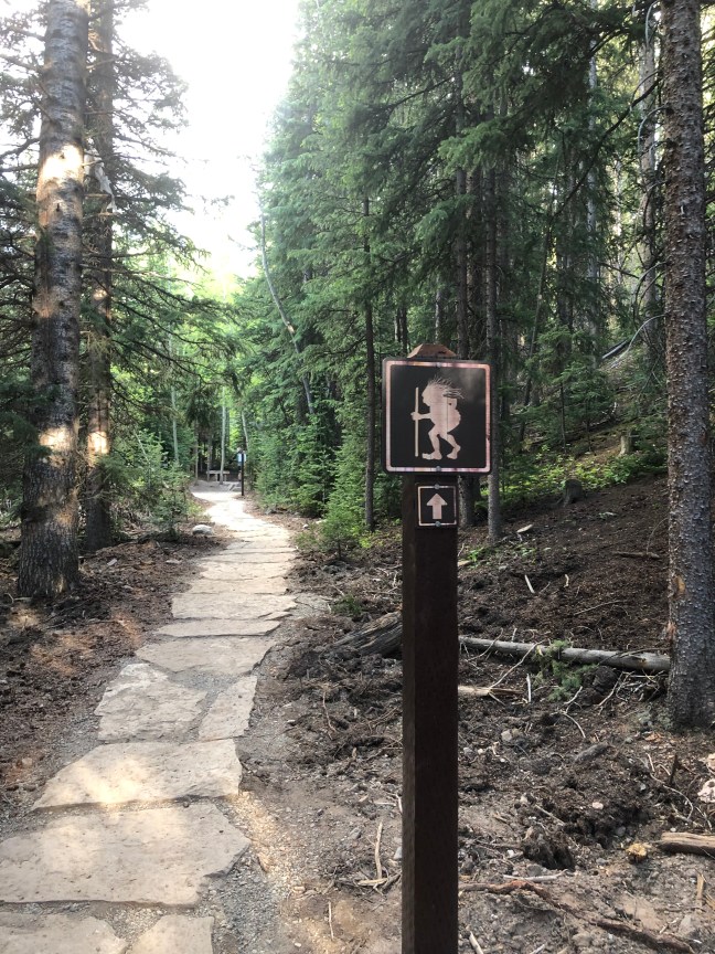
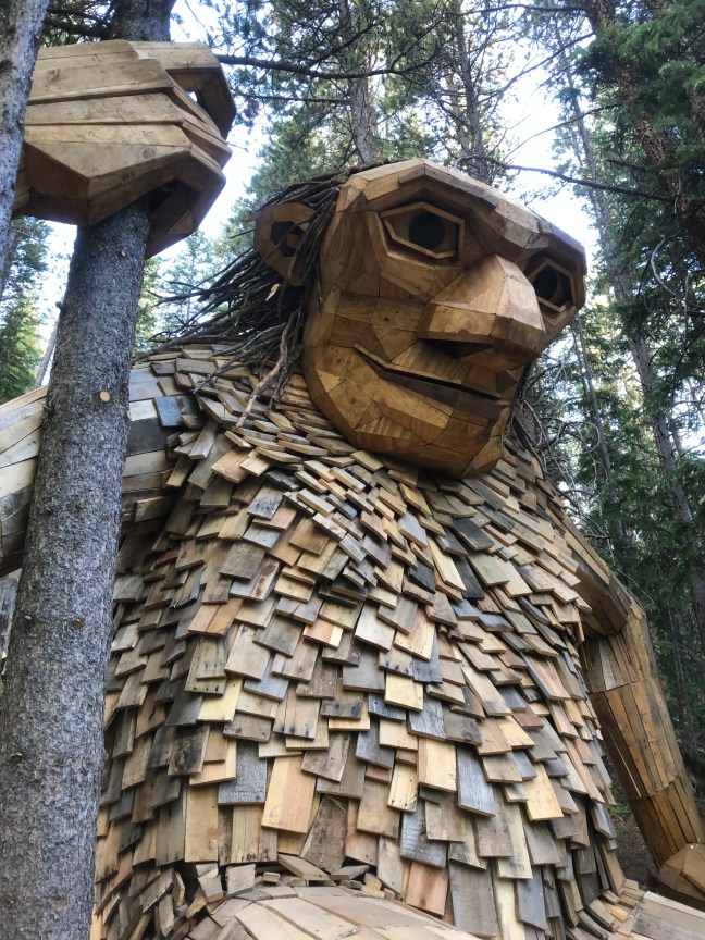
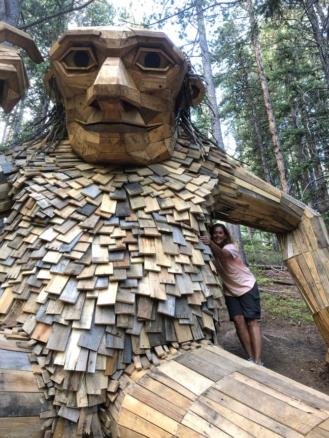
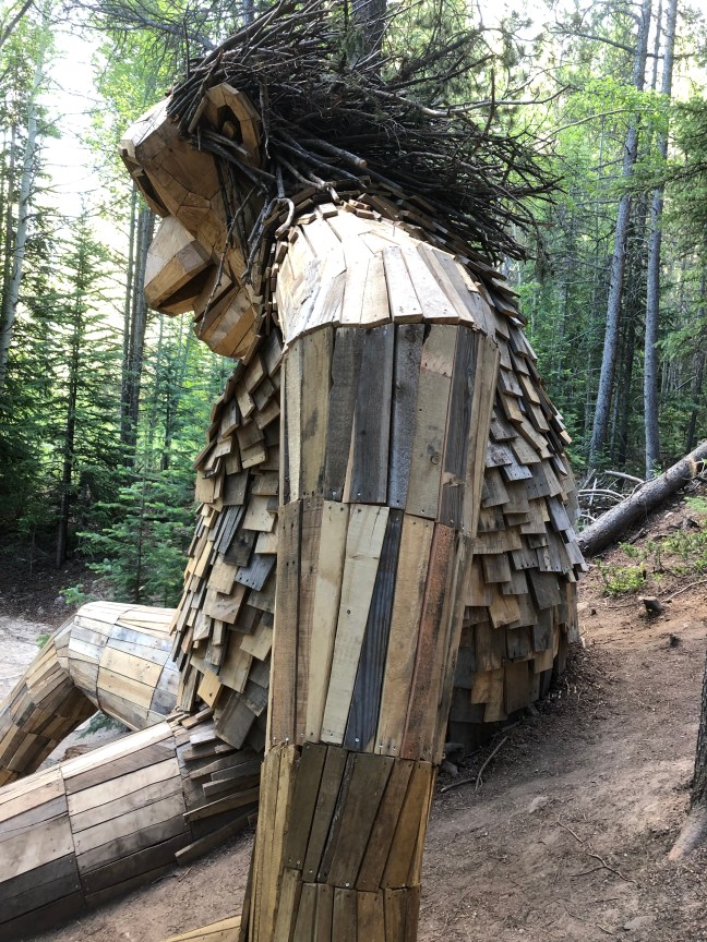
I really like unique hikes and this has to be one of the most unique hikes of all, because of what you find at the end, which in this case is a large troll. However, this is not a hike in the truest sense of the word being that it is so short and very much in the center of town. The troll, named Isak Heartstone, can be reached via the Trollstigen Trail in the town of Breckenridge, Colorado. The troll was designed by Thomas Dambo, a Copenhagen based artist who specializes in reduce-reuse-recycle (the troll is a combination of all three ‘R’s’.)
The trail is very short and flat, about 1/2 mile round trip so it is perfect for families with kids. Even without kids, a hike on the Trollstigen Trail is so different because of the wooden art troll at the turnaround. The troll stands at about 15’ tall and does not seem out of place at all. Breckenridge is one of many places around the world that can boast having one of these fairytale pieces of art.
The trailhead can be accessed from the center of town near the ice rink. We walked there from the town center, just to add a few more steps since the hike itself is so short but you can also take a shuttle to the trailhead.
For more information on the other trolls Thomas has built around the world look him up on social media to learn more about his projects and the vision he has to make the world a better place through art and recycling.
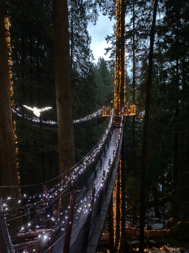
If you do any internet search for the top things to do in Vancouver, the Capilano Suspension Bridge Park will surely come up. It is as unique as it is popular, which is I guess what most people are looking to do on vacations right? I do not typically like to go to the heavily touristed spots, mostly because they are normally quite crowded. But during the winter months at Capilano, the crowds are significantly less than in the summer. I also don’t like to spend a lot for tickets and this place is pricey at $53.95 CAD per person. However, we spoke to another couple while we were taking in a Vancouver Canucks hockey game when we first arrived and they said it was a must do, especially if you go at night during the winter when the forest is decorated with lights for what the park calls Canyon Lights. So my wife and I decided to give it a go on a cold and rainy Vancouver night.
From the moment we walked into the place, we couldn’t help but notice how clean and organized it was, the word spotless came to mind. I was still skeptical if this was going to be worth the price of admission but once I saw all of the offerings, I started to feel quite encouraged.
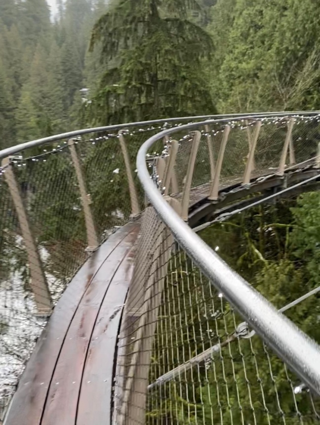
Most people immediately head for the parks namesake suspension bridge but we decided to do the Cliffwalk first. The walk is along a granite canyon face and is held in place with eight cables that are connected to a single anchor point. It sounds like it isn’t enough to keep you safe but when you see it, you just know it will do the job. As I’ve written in previous articles, I have an issue with heights so this was a true test for me, and I didn’t pee myself! Down below on the rainforest floor the Capilano River flows, and while walking along the Cliffwalk I was in awe as I saw two eagles following above the curve of the water. It was an unexpected bonus.
The Cliffwalk
Moving on to the suspension bridge, which takes you 230 above the Capilano River, you’ll sway for over 450 feet before planting your feet on terra firma on the other side. The walk across the bridge was exciting and began to give the park a Swiss Family Robinson feel, which we really enjoyed. Beware of tourists stopping suddenly in front of you all along the bridge to capture that ‘perfect’ selfie shot.
Capilano Suspension Bridge
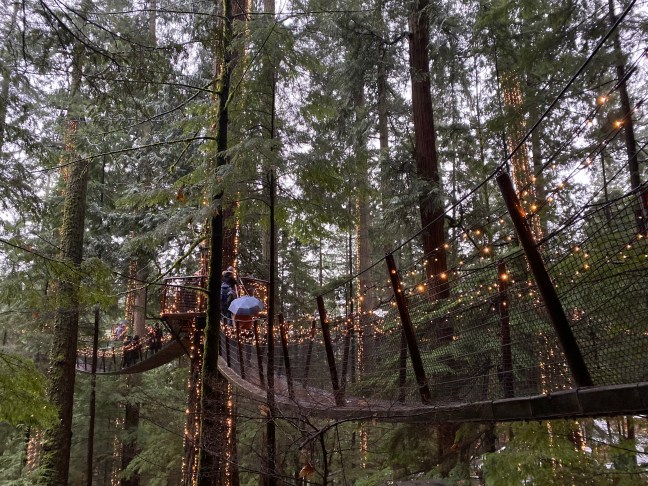
Once on the other side, you’ll see what is called the Treetops Adventure which is seven smaller suspension bridges strung between the evergreens as high off the ground as 100 feet. The Swiss Family Robinson feeling is now in full swing.
Treetops Adventure
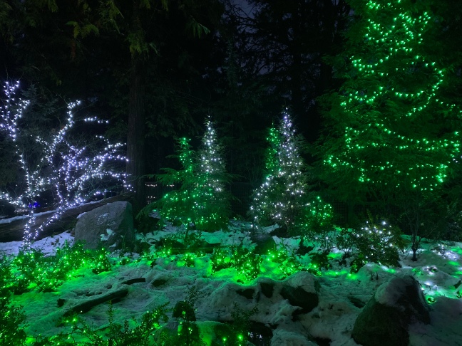
The park embraces native culture and you’ll find totem poles and other First Nations art on site. If you manage to be here at night during the winter holiday season, you’ll be treated to lights all over the place, adding even more character to the park.
We spent over four hours in the park and enjoyed every minute of it. It was expensive and a bit touristy but we loved it and it was so worth it. So if you’re ever in Vancouver, you should definitely go to the Capilano Suspension Bridge Park.
I’m convinced that you can hike anywhere, even in the cities. The Irish call it “walking” and some walks are more like hikes and hikes more like walks. Confusing? Just put on your pack and get out there! Ever walked in San Francisco? It’s harder than most hikes you can find in almost any National Park. Whenever I travel to a new place, I usually get out a map and start looking for blank spaces or green spots near to where I’m traveling to. On a recent trip to Indianapolis, I spent some time looking at a map and found some empty spaces and greenery south of the city in Brown County, near the small town of Nashville, Indiana that is. Brown County State Park (Indiana’s largest), Hoosier National Forest, and Yellowwood State Forest all show up well on the map and roughly just and hour or so from Indy.
The hills of Brown County State Park | Indiana
So let’s just start where I did, in Brown County State Park. The park has about 20 miles of hiking trails and another 27 that are multi-use, which compared to some other places is not much. But I didn’t come to Indiana to hike, it was on the back-end of a business trip that I extended a couple of days to see family in the area (Bloomington) and I managed a little exploring on the side as well. My hotel was in the quaint town of Nashville about a mile from the north entrance of the park and it turned out to be the perfect place to stretch my legs and get some fresh air. My first hike was on the 2.2 mile Fire Tower Trail (aka Trail 10) which follows ridges and ravines as a loop. The loop begins and ends at a 90’ converted fire lookout tower that now serves as an antenna tower open to visitors to climb. Admittedly, I have a healthy fear of heights and my first climb at the beginning of the hike ended in me seizing up about halfway to the top and turning around. After hiking the loop, I decided to try again and this time made it up to the top. I am actually a bit surprised that you are legally allowed to climb this tower but I’m grateful that it was. Nearby is a small nature center that I enjoyed so much that I realized that I’m getting old. Inside, there are living and non-living (taxidermy) fauna to view. Live animals included snakes like the Timber Rattlesnake, Copperhead, Black Rat, and Milk (red on black, friend of Jack). There is also a two-way mirror looking out into a bird feeder and this was clearly (intended pun) were all of the action was. Very fat squirrels battled it out for the primo spots and birds (including my favorite, the cardinal) tried to stay a safe distance away from them, while still managing a free meal.
Male Cardinal
Another nice trail in Brown County State Park was the short but scenic Ogle Lake Trail. At only 1.5 miles, the trail is really just a warmup to some of the other connected trails you can hike from this area. I connected to the Taylor Ridge Trail, which can add another 5.5 miles onto your hike (I didn’t make it that far).
Ogle Lake
All in all, there are plenty of shorter hiking options in southern Indiana that you might enjoy the next time you’re passing through. If you’re looking for some decent comfort food, try the Nashville General Store and Bakery in Nashville. For really good apres randonnee beers, try Upland Brewing Company in Columbus (I had more than one Modern Tart Kettle Sour Ale). So if you happen to be in Central Indiana and you need a nature fix for a day or two, Brown County is a good place to be.
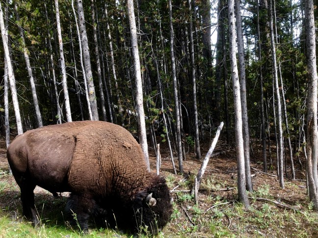
If you don’t get more than 100 feet from your car when you go to Yellowstone National Park (YNP) in Wyoming that would be a shame, but I will not judge you… however I would encourage you to hike your way to the front of the line. In doing so, you’ll leave the vast majority of the parks visitors far behind. YNP has some of the most incredible roadside attractions nature can offer: steaming geysers, large herds of bison, elk and deer, as well as apex predators like wolves and bears. But all of this nature in one place has one big disadvantage: Disneyland-like crowds with no skip the line pass to make viewing it all easier.
Bison or Buffalo?
My wife and I recently spent a few days in Yellowstone and roughly split our time equally between seeing large swaths of the park from, or very near to, our car with the other half of our trip walking into the woods to experience a much different Yellowstone than most people do. From the car, there are the massive Yellowstone Falls in the Grand Canyon of the Yellowstone as well as huge herds of bison that seem very comfortable weaving through the cars and people who dare to get too close. Bears are often seen here from your car and even wolves show face for those who are either lucky, or patient, or both. There are also thermal features within close proximity to parking lots such as the famous Old Faithful Geyser and the incredible colors of the Grand Prismatic Spring.
Lower Yellowstone Falls
If you get out of your car and venture into the woods, you may be rewarded with a much more intimate experience in one of America’s most popular national parks. Our first hike in the park was 4.8 miles round trip to Lone Star Geyser, which can erupt up to 45 feet into the sky. This geyser erupts every three hours so timing is everything, and we lucked out and arrived (with no planning mind you) only 10 minutes before the geyser went off. The hike is uphill to the geyser but is not steep and follows an old road that has been closed to automobile traffic (bikes are allowed). A few minutes of waiting after reaching the end of the road, the geyser began to pick up steam (pun intended) and showed rumbling signs that an eruption would be coming soon. The geyser erupted for about 18 minutes with water shooting up first, then a few minutes of steam and it was a wonderful reward for the relatively short 2.4 mile hike to get there. We felt like our efforts to have hiked there were instantly rewarded as there were only about 10 other people there to witness this very cool display whereas Old Faithful can have as many as 2,000 people watching an eruption. It was also refreshing to have an unobstructed view of the geyser with no signs or ropes in the way and the best part was that it truly felt like this is how we were meant to see it, au natural so to speak. We worked for this experience and we were richly rewarded for our efforts.
Lone Star Geyser
Our second hike was to see Fairy Falls which is accessed near the very busy Grand Prismatic Spring area. Once you get past the large crowds of this popular spot, you’ll find a much smaller group of sightseers on the way to the falls. Fairy Falls is a very tall (197 feet) cascade, one of the tallest in the park, but for us the true gem of this hike unexpectedly turned out to be Imperial Geyser. This geyser bubbled and burped the entire time we were there and again there was hardly a soul there, this time only four other hikers. If you make this an out and back, the distance is around six miles, but there are also options to add more distance by linking to other trails in the area, which we did to add another three miles or so. While on one of these connector trails, we came across a lone male bison just off trail that really capped off what was a very unique hike. Seeing a big bison from your car can be intimidating so imagine seeing one out on the trail! We stayed back a safe distance to take some photos and didn’t want to end up on the news like so many others recently who have gotten too close to a wild bison.
Imperial Geyser
Imperial Geyser
Not everyone can hike but if you can, do. I’m not trying to diminish the experience for others who do like to see the park from the relative safety of their cars and only walk the boardwalks. We did our fair share of this type of sightseeing, just like everyone else and it was great. However, wildlife encounters seem to have a more authentic feeling when you see them from the trail instead of the road. The power of a wild buffalo is more pronounced when you don’t have your car to save you. Walking through forests that have grizzly bears heightens your awareness to your surroundings (carry bear spray) and that also adds a different dynamic to the experience. Geysers and other natural features experienced miles from the nearest parking lot mean that you might have it all to yourself, without man-made barriers.
Twilight on Yellowstone Lake
So, if you can get a hike or two in during your stay, do it and you’ll be glad you did. Enjoy a more secluded Yellowstone experience because most people will be at the lodge, in their car, or never far from it, and that means you can experience something rare in Yellowstone, solitude.
Rocky Mountain National Park (RMNP) is the closest national park to my home in Colorado and I consider it my base park. It takes me about an hour to get there and I’ve been there enough to know how different the seasons are in both RMNP as well as in its gateway city, Estes Park. The seasons here are wildly different – from the extreme temperature swings to the number of visitors. Here is my take on what each of the four seasons is like:
Summer
Death and Renewal
Estes Park – In the summer, Estes Park is completely overrun with tourists. Despite this, it shouldn’t stop you from visiting. The weather is nearly perfect and is typically at least a few degrees cooler than the cities below on the plains, like Denver or Boulder. If you’re really looking for a cool down, you can cool off even more if you head high up into Rocky Mountian National Park. The town itself is a typical tourist town but with a mountain/western twist. There are the obligatory t-shirt, salt water taffy, chocolate, and ice cream shops that you would see in almost any national park gateway town. What makes Estes unique is the surrounding scenery, which wouldn’t be out of place in the Swiss Alps, with its huge snow-capped mountains and valleys. What is lacking though, in a good way, are flashy resorts as in other Colorado mountain towns like Vail or Aspen. Here, there are mostly small motels and cabins along with the place that Stephen King made famous, the Stanley Hotel.
15 feet of snow and it’s summertime
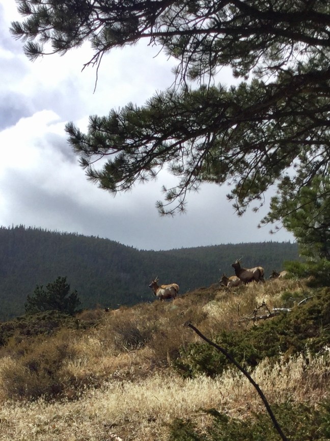
RMNP – The throngs of tourists are here too, unfortunately. However, all you need to do is to start a hike on almost any trail and you can lose 90% of them after only a mile or so from the trailhead. Hiking in summertime at these elevations means being prepared by starting early to avoid afternoon thunderstorms. If you don’t consider yourself a hiker, consider a drive up Trail Ridge Road, a journey which can yield a somewhat unique activity, a summertime snowball fight or building a snowman. The highest point in the pass is 12,183 feet (over two miles high) and that leaves enough snow year round for winter games, even in mid summer. The wildlife also move up to higher elevations in summertime, seeking greener pastures. Up at these higher altitudes, you might see large herds of elk and bighorn sheep in the alpine tundra, way above the height where trees grow.
Autumn
The bugling elk
Estes Park – Surprisingly, Estes park can still be quite busy during the fall. Some might think it has to do with fall colors but the area around Estes Park and Rocky Mountain National Park really doesn’t have an abundance of aspen trees. For most people, the primary reason they come up here in the fall is to hear and see elk during the ‘rut’ which is the mating season. And why would you want to hear bugling elk during the mating season? The reason is that their mating calls sound like a sort of ancient call that can be heard from far off. It is a difficult sound to explain and do it justice, but is a truly a breathtaking and mesmerizing experience to see and hear, and something that simply must be heard in person. This is the main reason people flock to Estes Park in the fall, the elk literally bugle as they’re walking on the golf course, through parking lots right in town, as well as on the grounds of the Stanley Hotel.
RMNP – As with in Estes Park, the reason to head into the national park at this time of year is to see and hear the elk. Although being bumper to bumper with like minded people might not seem like something you want to do, you can still go into the park and hike into the woods where you might find yourself all alone on the trail in the middle of a large herd of bugling Rocky Mountain Elk. Last October, my wife and I went on a hike, away from the main areas of the park, and started to hear bugling in the distance and were soon surrounded by around 100 elk on both sides of the trail without another human anywhere near us. The park brochure cautions you against approaching wildlife, so by all means keep your distance. But if you happen upon a large herd while hiking the trails, excercise extreme caution and keep a safe distance. I usually like to have a big tree nearby just in case. The bulls are extremely aggressive during this time of year and they are big, averaging around 700 lbs, and strong enough to inflict great bodily harm if they decide you’re too close.
Winter
Estes Park – If you’re looking to experience a tourist town without the tourists, this is the time of year to come to Estes Park! You will not have to fight for a table at your favorite restaurant, there will be no bumper to bumper traffic, there’s plenty of parking, and you can have the place virtually all to yourself. Unlike other Colorado mountain towns that usually see a massive influx of people in the winter, Estes doesn’t have a ski resort (although it once did) to anchor its winter economy. Because of this, Estes sees a very dramatic drop in visitation in the winter. As an added bonus, a stay at the Stanley Hotel in winter can give just a sliver of what inspired Stephen King to write ‘The Shining’.
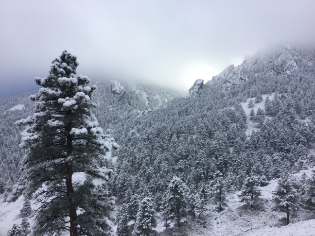
RMNP – The park is at its best, in terms of scenic beauty in the dead of winter. The mountains are usually covered with snow, sometimes approaching 10 feet. Winter activities include snowshoeing, cross country skiing, and wildlife viewing (although seeing animals inside the park during winter is less likely). Some areas, such as around Bear Lake, are still crowded but it can be much easier to find areas of the park where you’ll need your snowshoes to walk through the snow. It is simply one of the most beautiful winter scenes in all of Colorado.
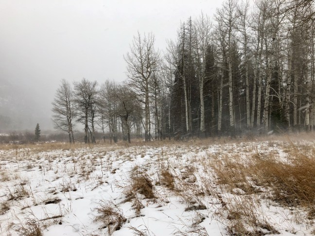
Spring
Always snow up in the highlands
Estes Park – This town still doesn’t really get going again until late spring. In most places, spring begins a steady warmup towards summertime but at this altitude and being in Colorado, Estes Park typically experiences its snowiest months of the year in the spring. Traditionally, February, March, and April are Colorado’s months for heavy snow and blizzards. Eventually however, the snows slowly give way to longer and warmer days and the area begins to thaw and creak to life.
RMNP – Spring in the park is the beginning of the big melt. The east and west sides of the park are connected by Trail Ridge Road, but due to heavy winter snow, the road is impassable until the weather warms and crews can begin plowing the road. When the road finally opens, it becomes symbolic of winter’s deep freeze losing it’s grip on the park. The animals get to moving again and the large numbers of people begin to make their way back to the park that had been tranquil for several months.
In any season, the area is unique and beautiful. During the cold winter months, it is quiet and peaceful. In the warmer months, it is energetic and bustling but no matter what season, it is worth a visit and will not disappoint.
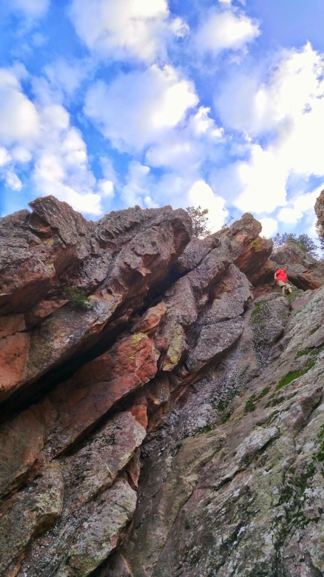
The less visited area of the park known as ‘Lumpy Ridge’
Some say that the Mount Sanitas Trail is Boulder’s quintessential hike. The hike is 3.1 miles round trip and has an elevation gain of around 1,350 feet but to me, there are better hikes in Boulder and although the Mount Sanitas Trail is a great (short) workout, it is not the most scenic hike in the area, in my opinion. To me, the hike that should be on everyone’s Boulder must do list is the Mesa Trail.
The Mesa Trail has almost the exact same elevation gain as the Mount Sanitas trail, but it spreads that elevation gain over a one way distance of about 6.8 miles. It may actually be one of the flatest hikes you can do in Colorado since it parallels the mountains rather than climbing up them.
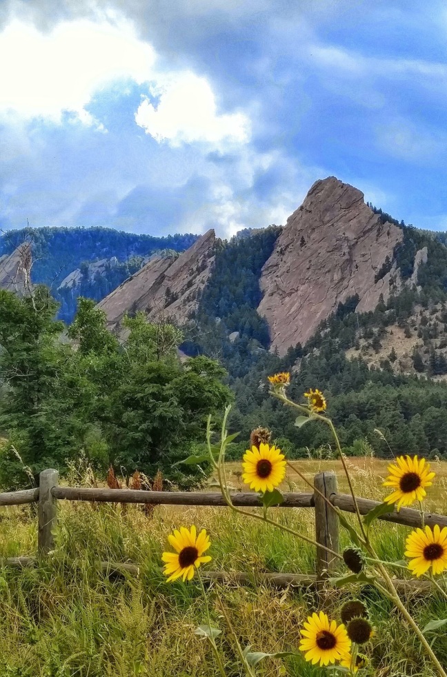
As far as scenery goes, there are few hikes anywhere in the country that can rival this one. The Flatirons are the rock formation that you see in every tourist magazine that features an article on Boulder. These five primary blocks of sandstone make for a spectacular backdrop for a day hike. In additon to the Flatirons, this is one of just a few areas along the Front Range where the pine forest actually comes all the way down over the foothills and onto the prairie below.
The trailhead at Chautauqua
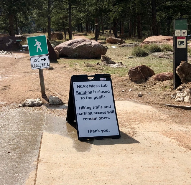
Another great aspect of this trail is its accessabiity. The trail has three primary trailheads: The South Mesa Trailhead, the Trailhead at the National Center for Atmospheric Reasearch (NCAR), and the Chautauqua Trailhead. Of the three, only the South Mesa Trailhead has a fee to park ($5). All three can be very crowded in the summer tourist season and on any weekend day when the weather is good. Go to NCAR if you want free parking and moderate crowds. The view here of the Flatirons is really good too but go to Chautauqua for the best view (the downside is the bigger crowds.) For a less crowded section of the trail, start at the South Mesa Trailhead. It is the least scenic of the three trailheads but it still has some decent views of the Flatirons, Boulder and even Denver off to the southeast.
Early summer flowers
The best part of hiking the Mesa Trail is that you have many options, and the hikes are all pretty accessible for most people. If you start at Chautauqua and NCAR, you can walk right up to one of the Flatirons and touch them within about 20 minutes after leaving the parking lot. Also of note is the many side trail options off of the main trail. If you’re looking for a longer hike, the side trails heading into the hills are nearly endless and offer you the opportunity to get a workout as good or better than the one you can get on Mt. Sanitas.
One of many trails that can be accessed from the Mesa Trail, the Mallory Cave Trail
In my opinion, the Mesa Trail pretty much has it all: great scenery, the option for longer hikes while all are within the close proximity of the city of Boulder. For a great après hike food/beer option, check out the Southern Sun for a laid back vibe and great beer just down the hill from the NCAR trailhead.
For most of the winter, the trail is still accessible and can still be hiked (microspikes recommended though)
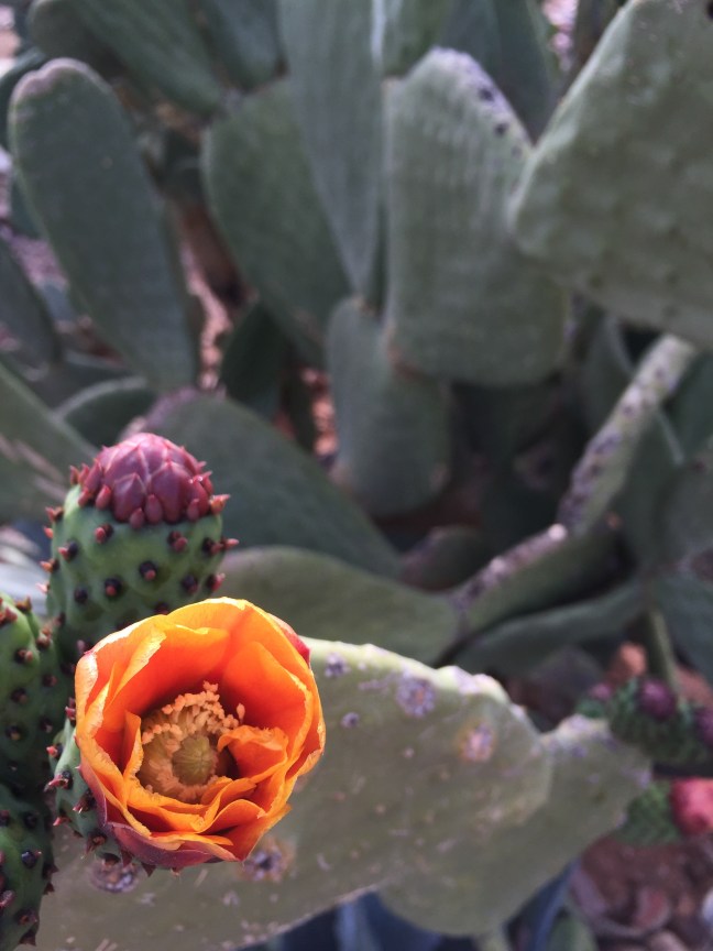
The Peralta Trail is a very popular Arizona hike, and with good reason. Being a relatively short drive from the Phoenix metropolitan area, it provides easy access to great hiking for the majority of Phoenicians (and snowbirds too!). Located on the eastern edge of town off of Highway 60, the drive really starts to get interesting once you leave the pavement of Peralta Road near the town of Gold Canyon. If you’re lucky enough to catch a cactus bloom in the springtime on this section of desert track, you may not even want to get out of the car to hike. There are so many cactus varieties and my botany background is weak but even I could identify flowering saguaro, ocotillo, and prickly pear, all blooming with different colored flowers.
Prickly Pear Cactus Flower, Gold Canyon AZ
The hike begins at the Peralta Trailhead in Tonto National Forest, although this forest is probably different than any other you’ve been to before. This “forest” isn’t full of many trees like you’d see in a traditional forest, but it does have the aforementioned cactus and there are some trees and shrubs along the creek bed. In those trees and shrubs, you may even have the chance to see an Arizona cardinal. When the football team moved to Arizona from St. Louis, I thought for sure a name change was in order because I’d never seen a cardinal west of Kansas, but there are real cardinals in Arizona and their color stands out vividly from the desert landscape.
Most people hike up approximately 2.5 miles to the overlook of Weavers Needle and then head back down. From the trailhead, the first 2.5 miles are almost all uphill with only a few spots along the way to get out of the sun. Take full advantage of these shady areas as the temperature can get pretty hot on the trail. Hiking in the spring and fall can offer temperatures that are decent enough, but summer hiking here would be borderline crazy. Temperatures in the Valley of the Sun can reach into the 110’s and sometimes even hotter. The day of our hike was a near perfect 84 degrees. Even still, we went through three bottles of water each and wish we would have had more. As a side note, when I was at Sky Harbor International Airport, one of the souvenir shops was selling t-shirts that read “Keep Phoenix Hot” along the lines of “Keep Portland Weird” I guess. Clever and I should have bought one!
Several trails can be accessed from the Peralta Trailhead
The trail
Once at the top, you get a spectacular view of Weavers Needle and the Nothern Arizona landscape in the distance. The view is hard earned so savor it, we were really tired and pretty much only stayed for a few minutes. A family sitting near us had packed sandwiches with them and I think my dad was about ready to pull out his wallet to try to buy one. At least one of the kids in the family was also packing heat on his belt and had a Crocodile Dundee worthy knife on it too. Arizona is known for having alternative politics and having kids with guns on a hiking trail is definitely a first for me. We’d seen a few other hikers with guns holstered along the trail throughout the day.
Next up is down, downhill that is. Hiking always seems harder going downhill for some reason. You’re already tired and you’re having to use your legs to slow your body down. This is also a good time to make sure that you focus because there may or may not be a rattlesnake on the trail, just sayin’! A couple was stopped on the trail ahead of us and one of them turned up the trail towards us to let us know that there is a four foot rattlesnake across the trail and to be careful. It was gone by the time we got there but our radar was definitely up from that point on. The couple also warned another hiker on the trail to be careful and when he got to us he had a walking stick and a holstered handgun. He said both were for the snakes. On a serious note, you do need to keep an eye out for snakes. Every place has its hazards. After talking with a few hikers, this snake (allegedly – innocent until proven guilty 🐍) had rattled as a warning to a group of hikers earlier. Here in the desert, the heat is a much bigger concern than the snakes but you need to be aware of both. Wear sunscreen and a hat for the sun and drink plenty of water. Walk softly and carry a big stick for the snakes or something like that says Teddy Roosevelt (not to hit them with of course but for gently nudging them to safety off of the trail, for their own good and for the good of anyone walking the trail, something I actually did a few days after this hike).
The view of Weavers Needle
After finishing the hike, there are many great Mexican restaurants in the Greater Phoenix area to choose from to load up on some of the carbs and sweat you lost out on the trail. We chose the outdoor seating at Los Gringos Locos in Apache Junction. I had a margarita, chips and salsa, a Dos Equis Amber, and a cheese crisp (basically an open faced crispy quesadilla) to cap off a great day hiking with family in the Arizona desert.